Jerusalem
The size and area of Jerusalem have varied over the ages depending on the city's importance, as well as the ability to solve problems related to water supplies and the length of periods of calm without raids or demolitions, in addition to the political situation and the interests of the parties involved. The significance of the city has often shifted between that of the spiritual and that of the secular. As is well known, Jerusalem is linked to more than half the population of the globe from the spiritual aspect. Secular Jerusalem, in its present form and population, may not be considered important for them, but the religious symbols encompassed within this holy city are definitely important to them. Furthermore, Jerusalem holds a holy scene that includes the majority of the Old City and its surroundings. The name "Jerusalem" may not depict, in terms of the area, the same location over the different ages.
A number of terms used in this aspect require clarification:
1. The Old City
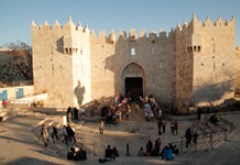
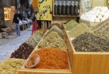
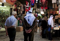
The present day Old City is surrounded by the walls built by the Ottoman Sultan Suleiman I, known as Al-Kanuni (the Lawgiver) in the 16th century. The wall has seven open gates, most important of which is Bab Al-Amoud (Damascus Gate) in the north and Bab Al-Magharibah (Dung Gate) in the west. Jerusalem was traditionally divided into four quarters or neighborhoods for Muslims, Christians, Armenians, and Jews. These are symbolic divisions that express the congregation of communities around their holy sites. All neighborhoods were mixed, and the division first appeared in western literature at the beginning of the 19th century. The area of the Old City is less than one square kilometer, and is inhabited by about 40,000 people, 3000 of whom are Jewish settlers. The rest are Muslim and Christian Palestinians. The Old City hosts the most important holy sites of the three monotheistic religions, and is dotted with sacred buildings, such as churches, mosques, and synagogues, as well as a large number of historic buildings representing the different eras of history that prevailed throughout the east Mediterranean region, ranging from Roman era and into the 20th century. The Old City also houses a large number of old markets that depict the spirit of the orient.
During the Ottoman era, Jerusalem was named Al-Quds Al-Sharif, (The Noble Holy City), referring to the Old City, and possibly its close surroundings. Both the Old City and its walls are registered as a UNESCO World Heritage Site.
2. Jerusalem under British Mandate
The British Mandate expanded the limits of the city of Jerusalem by a few kilometers to the west, reaching the outskirts of the village of Lifta. These borders laid the foundations for the decision to divide the city. In the north, Jerusalem's borders were extended to Al-Sheikh Jarrah, and in the east to the western slopes of the Mount of Olives, while in the south, it was extended to Jabal Al-Mukabber. With this division, many Palestinian communities were excluded from Jerusalem, including Silwan, Al-Tor, Al-Issawiyah, Al-Izariyah, and Abu Deis, while these borders included almost all Jewish settlements surrounding Jerusalem, particularly those west of the city. Doubtlessly, planning the city of Jerusalem during that crucial period was not void of political intentions, including ensuring that a Jewish majority remains within the city's municipal borders.
3. Jerusalem in the Partition Resolution
In 1947, the United Nations adopted a resolution to divide Palestine into three regions: An Arab state, a Jewish state, and the city of Jerusalem that would be under temporary international administration referred to as a "special status" (Corpus Separatum), which included a large area comprising Bethlehem, Bait Sahour, and Bait Jala in the south, reaching Bait Hanina in the north, Al-Izariyah and Abu Deis in the east, and Ain Karem, Lifta, Dair Yassin, and Al-Malha in the west.
4. Divided Jerusalem
As a result of the 1948 war, Jerusalem was divided with an armistice line into two sections. The border was delineated a few meters from Bab Al-Amoud along the current Highway 1. The western part of the northern wall of the Old City and the western part of the southern wall formed the line separating the two sectors. Jordanian soldiers stood on top of the city walls, facing Israeli soldiers on the other side.
A. Western Sector: The Western Sector comprises more than 80% of the area of Jerusalem's municipal borders. It includes the majority of the modern and contemporary Arab neighborhoods, with their beautiful buildings, gardens and libraries, and all Jewish and mixed neighborhoods, including the Municipality building, the Post Office, the Railroad building, sources of electricity and water, modern markets, the road to the port Jaffa, etc. About 70,000 Palestinians were displaced from this sector and its rural areas, with no Palestinians are left there. After its establishment, Israel declared Jerusalem its capital, building the Knesset, and moving its president's headquarters, the prime minister's headquarters, and some ministries to Jerusalem's western sector.
B. The Eastern Sector: This part of Jerusalem contained the rest of Jerusalem, including the Old City and the surrounding area, with a total of 6.5 square kilometers. With the exception of the Old City, the Eastern Sector did not receive any life-support services, but large numbers of refugees instead. Jorden annexed this part, together with the West Bank, and upgraded the status of Jerusalem to a second capital of the Kingdom, after Amman. Even if Jordan wanted to develop this region, its capacities were limited and the city's challenges were immense. Nevertheless, it built some schools, court houses, a post office, a hospital, etc. It could not, however, compensate it for what it lost in the western sector.
5. Jerusalem after June 1967
In the June 1967 war, Israel occupied the eastern sector of Jerusalem and the rest of the Palestinian lands in the West Bank and the Gaza Strip. It took deep measures that affected the reality and future of the Holy City, first of which was expanding the area of the eastern sector from 6.5 to 72 square kilometers, annexing vast areas of the West Bank to Israeli Jerusalem, noting that the area of the western sector was 35 square kilometers. This means that two-thirds of the area of "United Jerusalem" area is in the eastern sector. The Arab municipality was dissolved and absorbed in the Israeli municipality. The Israeli government applied the Israeli law in the eastern sector, which practically meant its annexation to Israel. It then declared Jerusalem as "Israel's Unified Capital Forever," enacting a special law for this purpose in the Knesset in 1980. The annexation decision covered the land but not the Palestinian people who lived on it. Hence, the Palestinian in Jerusalem has a conditional right to residency in the city, but as a resident and not a citizen, as if Palestinians in Jerusalem came as visitors to the city and were not its original people, and as if Israel was not the party that occupied the city by force and annexed it to its authority. This "legal" reality of the Palestinian residents of Jerusalem has not changed since then.
Israel also undertook a concentrated settlement process that included all Arab neighborhoods and their surroundings in the city. These settlements formed a number of rings as follows:
A. Settlements separating the eastern sector from the rest of the West Bank.
B. Settlements separating Palestinian neighborhoods from one another.
C. Settlements inside Palestinian neighborhoods.
D. Settlements inside Palestinian homes.
The settlement activity in the eastern sector aims at achieving a set of de facto situations:
A. Attaining a Jewish majority in the eastern sector.
B. Separating Jerusalem completely from the rest of the West Bank and creating realities that cannot revert to the original status.
C. Forming displacement factors for the Palestinians to compel them to leave the city.
D. Fragmenting the social fabric of the eastern sector.
E. Stifling the Palestinian neighborhoods and leaving them nor room to expand and grow.
Separating Jerusalem from the rest of the West Bank was further enhanced by the construction of an Apartheid wall.
6. The Holy Basin (The Historic Basin):
This is an Israeli term that was first used at the Israeli - Palestinian negotiations table in Camp David in 2000, referring to the Old City and its surroundings. The term includes the Old City, the Mount of Olives from the east, edges of Shaikh Jarrah and Wadi El-Jouz from the north, Silwan from the south, and the Old City wall from the west. This area includes almost all the holy sites. Israel attempted to separate this part of Jerusalem from the rest of the city and to put it within a special parameter, but the Palestinians rejected this scheme and considered this part as an integral part of Jerusalem that was occupied in 1967. They were, however, ready to reach arrangements that would ensure free access to the holy sites. The Camp David and other negotiations were not successful, and the term continues to be repeated in Israeli literature.
7. Current Status of Jerusalem
Area: (Both East and West) About 125.2 square kilometers, of which 53 square kilometers are in the western part, while the rest, around 72 square kilometers, are in the eastern part.
Population: The population of east and west Jerusalem is over 900,000 people, of whom 370,000 are Palestinians. After more than half a century of Israeli control of the eastern sector, Jerusalem is more divided than ever since 1948. Differences between the two sides increased to an amazing level, affecting all economic, social, cultural, religious, legal, infrastructural, and other aspects of life.
The truth of the matter is that there is not only two different cities, but also two entirely different worlds. It is possible today to see the division lines clearly. It is sufficient to look at the infrastructure or the economy to see the lines of separation.
Palestinians represent about 39% of the total population of what is called "unified Jerusalem," living in 13% of the eastern sector only. The rest of Palestinian land in the city has been confiscated for Jewish settlement purposes, as green areas (actually reserved for settlement), archaeological sites, bypass roads to connect the West Bank settlement with Jerusalem, etc. This has created a housing crisis for the residents of the eastern sector of the city. Palestinian residents of Jerusalem now are in need of more than 20,000 residential units, and the same applies for schools, parks, and the entire infrastructure.
Out of the 370,000 Palestinian residents of Jerusalem, about 100,000 have been separated from their city, schools, hospitals, and work places by the wall. The lives of another 100,000 Palestinians are hindered by checkpoints that were planted around their city, which they cannot leave or return to without being searched at these checkpoints, including long delays and psychological stress that generates violence. Eighty percent of Jerusalem's Palestinians live under the poverty line and suffer from poverty-related diseases. Their neighborhoods have been turned to tin sheet slums that suffer from overcrowding. Palestinians also constitute the basic, untrained and unskilled labor force that cleans the Western Jerusalem and works in building sites and transportation.
8. Jerusalem in International Law
The issue of Jerusalem continues to be unresolved in international law. According to this law, the international status (Corpus Separatum) remains valid, with no country recognizing the city, whether divided or united, as the capital of Israel. For this reason, all international embassies are located in Tel Aviv, including the United States Embassy. There are no embassies in Jerusalem. The consulates existing in the city are remnants of the Ottoman legacy. All countries of the world acknowledge that East Jerusalem is occupied land and is an integral part of the Palestinian land occupied in 1967. This is stressed by dozens of international resolutions issued by the United Nations, which consider Israeli decisions null and void, and are in violation of international law.

