


The next station of this trail is Wadi al-Qilt, accessed from the Jerusalem - Jericho road (Route No. 1). Follow the signs, and after driving about 6 kilometers after Mishor Adumim, turn left at the Mitzpe Jericho sign. The valley can also be approached from Jericho. In the past, the road was open in both directions, but at present, the road is open until the entrance of St. George Monastery (Dair Wadi al-Qilt.)
Wadi al-Qilt has numerous viewpoints with spectacular views of purity and simplicity, representing the desert environment, although the Wadi, located in the heart of the Jerusalem eastern mountains, is a mere few kilometers from civilization. The first viewpoint is located directly after exiting Route 1. After driving for one kilometer passing Mishor Adumium Junction (Abu George Road), an old caravanserai building (The Good Samaritan) can be seen . keep going on the road no 1, and turn left Mitzpe Jericho sign, the visitor comes to a T-junction, where one can ascend the hill and see the valley and its surroundings, or head right (east) and continue down the narrow, steep-elevated, paved road to its end at the entrance to Wadi al-Qilt Monastery and a circular parking area. The vehicle must be left here, after making sure that no personal belongings are visible inside it and that it is securely locked. Walk down the footpath to visit the Monastery or stop for a spectacular view from a viewpoint overlooking it and the Wadi. At the beginning of the footpath, one can see the remains of an underground water cistern, from which the monks used to provide water to passers-by and pilgrims.
Wadi al-Qilt is one of the western tributaries of the River Jordan, conveying rain and spring water from the eastern slopes of the Jerusalem and al-Bire hills. The valley extends for 35 kilometers from beginning to end where it joins the Jericho valley. It has a steep elevation resulting from powerful erosion forces. Rocks of this valley are from the Paleocene age, composed of shale and calcium as well as flint layers, all dating back to the 4th geological period.
It is noteworthy that this valley crosses the Syrian African rift valley at the foothills of Jerusalem. It offers spectacular geological formations and rich natural scenes, covered with numerous flora and fauna, and a number of natural springs (Ein Fara, Ein al-Fawwar), which recharge in winter from the rainfall on the Jerusalem mountains, especially those east of the water division line. Streams and waterfalls run during winter and spring, and sometimes extend into early summer.
A stream runs in the valley throughout the year, carried by a canal originally built by King Herod (37-4 BC) but renovated a number of times, most recently during the British mandate. A bridge dates back to Roman times and was also renovated and maintained during the Byzantine, Umayyad, and later periods. A number of viewpoints on the surrounding hilltops give a good idea of the historical and natural scenery of the Holy Land and the Jerusalem mountains.
Wadi al-Qilt Trails
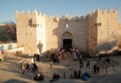
The Wadi has a number of hiking trails, most of which follow the old Roman route. The most scenic part starts 16 kilometers from the city of Jerusalem after al-Khan al-Ahmar (the Red Caravanserai, the Good Samaritan)), branching from the Jerusalem Jericho road eastward and flanking the valley until it reaches the Jericho plateau (currently closed in the middle) at the city’s southern entrance, where the Winter Palaces of King Herod are located (Tloul abu al-‘Alayeq). Among the main features of the valley is Dair Wadi al-Qilt, or the Monastery of St. George, built during the Byzantine times. The valley has spectacular scenes and unique geological formations and is surrounded by a number of caves, some of which were used by monastic monks during the Byzantine period.